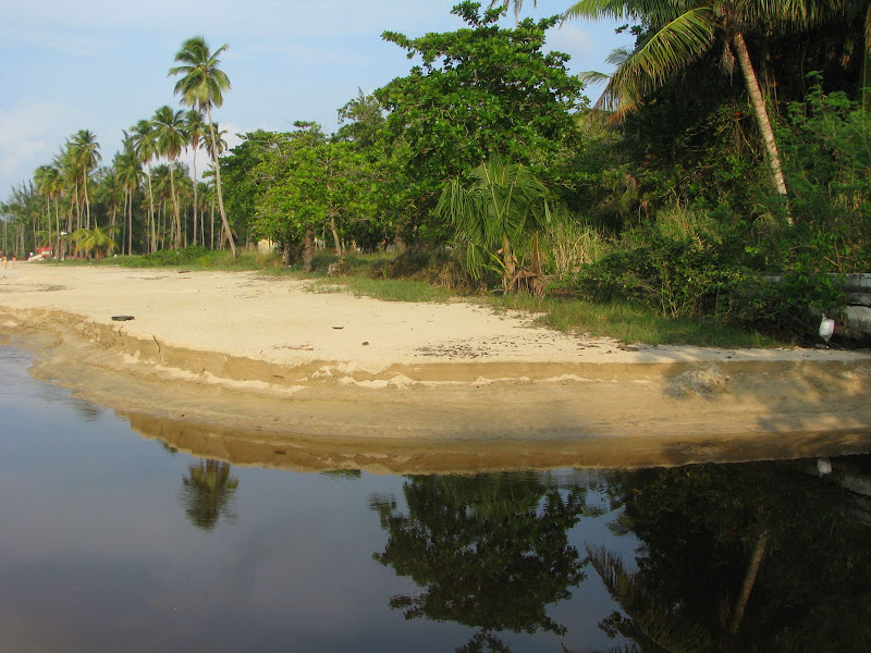
Chichen Itza is the largest Maya constuction and also the largest pre Colombus contruction. Is situated betwen Merida and Valladolid, in the Yucatan state and Yucatan peninsula. Chichen Itza is also one of the new seven wonders in the world.
If you want to go there, there are public buses from everywhere, so don´t worry about that. Also you shoul visit some cenotes close to Chicen Itza, I give you some advises, Dzitnup Zenote and Samula Zenote.
Chichen Itza, was a large pre-Columbian city built by the Maya civilization. The archaeological site is located in the municipality of Tinúm, in the Mexican state of Yucatán.
Chichen Itza was a major focal point in the northern Maya lowlands from the Late Classic (c.600–900 AD) through the Terminal Classic (c.800–900) and into the early portion of the Early Postclassic period (c.900–1200). The site exhibits a multitude of architectural styles, reminiscent of styles seen in central Mexico and of the Puuc and Chenes styles of the northern Maya lowlands. The presence of central Mexican styles was once thought to have been representative of direct migration or even conquest from central Mexico, but most contemporary interpretations view the presence of these non-Maya styles more as the result of cultural diffusion.
Chichen Itza was one of the largest Maya cities and it was likely to have been one of the mythical great cities, or Tollans, referred to in later Mesoamerican literature. The city may have had the most diverse population in the Maya world, a factor that could have contributed to the variety of architectural styles at the site.
The ruins of Chichen Itza are federal property, and the site’s stewardship is maintained by Mexico’s Instituto Nacional de Antropología e Historia (National Institute of Anthropology and History, INAH). The land under the monuments had been privately-owned until 29 March 2010, when it was purchased by the state of Yucatán.
Chichen Itza is one of the most visited archaeological sites in Mexico; an estimated 1.2 million tourists visit the ruins every year.
The Maya name "Chich'en Itza" means "At the mouth of the well of the Itza." This derives from chi', meaning "mouth" or "edge", and ch'en or ch'e'en, meaning "well." Itzá is the name of an ethnic-lineage group that gained political and economic dominance of the northern peninsula. One possible translation for Itza is "wizard (or enchantment) of the water."
The name is represented as Chichén Itzá in Spanish and the accents are sometimes maintained when translated into other languages to show that both parts of the name are stressed on their final syllables. Other references prefer to employ a more rigorous orthography in which the word is written according to the Yucatec Maya language, using Chich'en Itza'. This form preserves the phonemic distinction between ch' and ch, since the base word ch'e'en (which, however, does have a neutral tone vowel "e" in Maya and is not accented or stressed in Maya) begins with a glottalized affricate. The word "Itza'" has a high rise final "a" that is followed by a glottal stop (indicated by the apostrophe).
There is evidence in the Chilam Balam books that there was another, earlier name for this city prior to the arrival of the Itza hegemony in northern Yucatán. While most sources agree the first word means seven, there is considerable debate as to the correct translation of the rest. This earlier name is difficult to define because of the absence of a single standard of orthography, but it is represented variously as Uuc Yabnal ("Seven Great House"), Uuc Hab Nal ("Seven Bushy Places"), Uucyabnal ("Seven Great Rulers") or Uc Abnal ("Seven Lines of Abnal"). This name, dating to the Late Classic Period, is recorded both in the book of Chilam Balam de Chumayel and in hieroglyphic texts in the ruins.
Chichen Itza is located in the eastern portion of Yucatán state. The northern Yucatán Peninsula is arid, and the rivers in the interior all run underground. There are two large, natural sink holes, called cenotes, that could have provided plentiful water year round at Chichen, making it attractive for settlement. Of the two cenotes, the "Cenote Sagrado" or Sacred Cenote (also variously known as the Sacred Well or Well of Sacrifice), is the most famous. According to post-Conquest sources (Maya and Spanish), pre-Columbian Maya sacrificed objects and human beings into the cenote as a form of worship to the Maya rain god Chaac. Edward Herbert Thompson dredged the Cenote Sagrado from 1904 to 1910, and recovered artifacts of gold, jade, pottery and incense, as well as human remains. A study of human remains taken from the Cenote Sagrado found that they had wounds consistent with human sacrifice.
The layout of Chichen Itza site core developed during its earlier phase of occupation, between 750 and 900 AD. Its final layout was developed after 900 AD, and the 10th century saw the rise of the city as a regional capital controlling the area from central Yucatan to the north coast, with its power extending down the east and west coasts of the peninsula. The earliest hieroglyphic date discovered at Chichen Itza is equivalent to 832 AD, while the last known date was recorded in the Osario temple in 998.
The Late Classic city was centred upon the area to the southwest of the Xtoloc cenote, with the main architecture represented by the substructures now underlying the Las Monjas and Observatorio and the basal platform upon which they were built.
Chichen Itza rose to regional prominence towards the end of the Early Classic period (roughly 600 AD). It was, however, towards the end of the Late Classic and into the early part of the Terminal Classic that the site became a major regional capital, centralizing and dominating political, sociocultural, economic, and ideological life in the northern Maya lowlands. The ascension of Chichen Itza roughly correlates with the decline and fragmentation of the major centers of the southern Maya lowlands.
As Chichen Itza rose to prominence, the cities of Yaxuna (to the south) and Coba (to the east) were suffering decline. These two cities had been mutual allies, with Yaxuna dependent upon Coba. At some point in the 10th century Coba lost a significant portion of its territory, isolating Yaxuna, and Chichen Itza may have directly contributed to the collapse of both cities.
According to Maya chronicles (e.g., the Book of Chilam Balam of Chumayel), Hunac Ceel, ruler of Mayapan, conquered Chichen Itza in the 13th century. Hunac Ceel supposedly prophesied his own rise to power. According to custom at the time, individuals thrown into the Cenote Sagrado were believed to have the power of prophecy if they survived. During one such ceremony, the chronicles state, there were no survivors, so Hunac Ceel leaped into the Cenote Sagrado, and when removed, prophesied his own ascension.
While there is some archaeological evidence that indicates Chichén Itzá was at one time looted and sacked, there appears to be greater evidence that it could not have been by Mayapan, at least not when Chichén Itzá was an active urban center. Archaeological data now indicates that Chichen Itza fell by around AD 1000, some two centuries before the rise of Mayapan. Ongoing research at the site of Mayapan may help resolve this chronological conundrum.
While Chichén Itzá “collapsed” (meaning elite activities ceased) it may not have been abandoned. When the Spanish arrived, they found a thriving local population, although it is not clear from Spanish sources if Maya were living in Chichen Itza or nearby. The relatively high density of population in the region was one of the factors behind the conquistadors' decision to locate a capital there. According to post-Conquest sources, both Spanish and Maya, the Cenote Sagrado remained a place of pilgrimage.
In 1526 Spanish Conquistador Francisco de Montejo ( a veteran of the Grijalva and Cortés expeditions) successfully petitioned the King of Spain for a charter to conquer Yucatán. His first campaign in 1527, which covered much of the Yucatán peninsula, decimated his forces but ended with the establishment of a small fort at Xaman Ha', south of what is today Cancún. Montejo returned to Yucatán in 1531 with reinforcements and established his main base at Campeche on the west coast. He sent his son, Francisco Montejo The Younger, in late 1532 to conquer the interior of the Yucatán Peninsula from the north. The objective from the beginning was to go to Chichén Itzá and establish a capital.
Montejo the Younger eventually arrived at Chichen Itza, which he renamed Ciudad Real. At first he encountered no resistance, and set about dividing the lands around the city and awarding them to his soldiers. The Maya became more hostile over time, and eventually they laid siege to the Spanish, cutting off their supply line to the coast, and forcing them to barricade themselves among the ruins of ancient city. Months passed, but no reinforcements arrived. Montejo the Younger attempted an all out assault against the Maya and lost 150 of his remaining forces. He was forced to abandon Chichén Itzá in 1534 under cover of darkness. By 1535, all Spanish had been driven from the Yucatán Peninsula.
Montejo eventually returned to Yucatán and, by recruiting Maya from Campeche and Champoton, built a large Indio-Spanish army and conquered the peninsula. The Spanish crown later issued a land grant that included Chichen Itza and by 1588 it was a working cattle ranch.
Chichen Itza entered the popular imagination in 1843 with the book Incidents of Travel in Yucatan by John Lloyd Stephens (with illustrations by Frederick Catherwood). The book recount ed Stephens’ visit to Yucatán and his tour of Maya cities, including Chichén Itzá. The book prompted other explorations of the city. In 1860, Desire Charnay surveyed Chichén Itzá and took numerous photographs that he published in Cités et ruines américaines (1863).
In 1875, Augustus Le Plongeon and his wife Alice Dixon Le Plongeon visited Chichén, and excavated a statue of a figure on its back, knees drawn up, upper torso raised on its elbows with a plate on its stomach. Augustus Le Plongeon called it “Chaacmol” (later renamed “Chac Mool,” which has been the term to describe all types of this statuary found in Mesoamerica). Teobert Maler and Alfred Maudslay explored Chichén in the 1880s and both spent several weeks at the site and took extensive photographs. Maudslay published the first long-form description of Chichen Itza in his book, Biologia Centrali-Americana.
In 1894 the United States Consul to Yucatán, Edward H. Thompson purchased the Hacienda Chichén, which included the ruins of Chichen Itza. For 30 years, Thompson explored the ancient city. His discoveries included the earliest dated carving upon a lintel in the Temple of the Initial Series and the excavation of several graves in the Ossario (High Priest’s Temple). Thompson is most famous for dredging the Cenote Sagrado (Sacred Cenote) from 1904 to 1910, where he recovered artifacts of gold, copper and carved jade, as well as the first-ever examples of what were believed to be pre-Columbian Maya cloth and wooden weapons. Thompson shipped the bulk of the artifacts to the Peabody Museum at Harvard University.
In 1913, the Carnegie Institution accepted the proposal of archaeologist Sylvanus G. Morley and comm itted to conduct long-term archaeological research at Chichen Itza. The Mexican Revolution and the following government instability, as well as World War I, delayed the project by a decade.
In 1923, the Mexican government awarded the Carnegie Institution a 10-year permit (later extended another 10 years) to allow U.S. archaeologists to conduct extensive excavation and restoration of Chichen Itza. Carnegie researchers excavated and restored the Temple of Warriors and the Caracol, among other major buildings. At the same time, the Mexican government excavated and restored El Castillo and the Great Ball Court.
In 1926, the Mexican government charged Edward Thompson with theft, claiming he stole the artifacts from the Cenote Sagrado and smuggled them out of the country. The government seized the Hacienda Chichén. Thompson, who was in the United States at the time, never returned to Yucatán. He wrote about his research and investigations of the Maya culture in a book People of the Serpent published in 1932. He died in New Jersey in 1935. In 1944 the Mexican Supreme Court ruled that Thompson had broken n o laws and returned Chichen Itza to his heirs. The Thompsons sold the hacienda to tourism pioneer Fernando Barbachano Peon.
There have been two later expeditions to recover artifacts from the Cenote Sagrado, in 1961 and 1967. The first was sponsored by the National Geographic, and the second by private interests. Both projects were supervised by Mexico's National Institute of Anthropology and History (INAH). INAH has conducted an ongoing effort to excavate and restore other monuments in the archaeological zone, including the Ossario, Akab D’zib, and several buildings in Chichén Viejo (Old Chichen).
In 2009, to investigate construction that predated El Castillo, Yucatec archaeologists began excavations adjacent to El Castillo under the direction of Rafael (Rach) Cobos.
Chichen Itza was one of the largest Maya cities, with the relatively densely clustered architecture of the site core covering an area of at least 5 square kilometres (1.9 sq mi). Smaller scale residential architecture extends for an unknown distance beyond this. The city was built upon broken terrain, which was artificially levelled in order to build the major architectural groups, with the greatest effort being expended in the levelling of the areas for the Castillo pyra mid, and the Las Monjas, Osario and Main Southwest groups. The site contains many fine stone buildings in various states of preservation, and many have been restored. The buildings were connected by a dense network of paved causeways, called sacbeob. Archaeologists have identified over 80 sacbeob criss-crossing the site, and extending in all directions from the city.
The architecture encompasses a number of styles, including the Puuc and Chenes styles of the northern Yucatán Peninsula. The buildings of Chichen Itza are grouped in a series of architectonic sets, and each set was at one time separated from the other by a series of low walls. The three best known of these complexes are the Great North Platform, which includes the monuments of El Castillo, Temple of Warriors and the Great Ball Court; The Ossario Group, which includes the pyramid of the same name as well as the Temple of Xtoloc; and the Central Group, which includes the Caracol, Las Monjas, and Akab Dzib.
South of Las Monjas, in an area known as Chichén Viejo (Old Chichén) and only open to archaeologists, are several other complexes, such as the Group of the Initial Series, Group of the Lintels, and Group of the Old Castle.


Los guerreros temple, columns chiche itza yucatan mex We in the Caracol or Observatory


Sacred snake in the big pyramid
chichen itza mexicotravel viaja gratis free vacation vacaciones Nun House, Chichen Itza
May 2008
 Is situated betwen Merida and Valladolid, in the Yucatan state and Yucatan peninsula. Chichen Itza is also one of the new seven wonders in the world.
If you want to go there, there are public buses from everywhere, so don´t worry about that. Also you shoul visit some cenotes close to Chicen Itza, I give you some advises, Dzitnup Zenote and Samula Zenote.
Chichen Itza, was a large pre-Columbian city built by the Maya civilization. The archaeological site is located in the municipality of Tinúm, in the Mexican state of Yucatán.
Chichen Itza was a major focal point in the northern Maya lowlands from the Late Classic (c.600–900 AD) through the Terminal Classic (c.800–900) and into the early portion of the Early Postclassic period (c.900–1200). The site exhibits a multitude of architectural styles, reminiscent of styles seen in central Mexico and of the Puuc and
 Chenes styles of the northern Maya lowlands. The presence of central Mexican styles was once thought to have been representative of direct migration or even conquest from central Mexico, but most contemporary interpretations view the presence of these non-Maya styles more as the result of cultural diffusion.
Chichen Itza was one of the largest Maya cities and it was likely to have been one of the mythical great cities, or Tollans, referred to in later Mesoamerican literature. The city may have had the most diverse population in the Maya world, a factor that could have contributed to the variety of architectural styles at the site.
The ruins of Chichen Itza are federal property, and the site’s stewardship is maintained by Mexico’s Instituto Nacional de Antropología e Historia (National Institute of Anthropology and History, INAH). The land under the monuments had been privately-owned until 29 March 2010,
 when it was purchased by the state of Yucatán.
Chichen Itza is one of the most visited archaeological sites in Mexico; an estimated 1.2 million tourists visit the ruins every year.
The Maya name "Chich'en Itza" means "At the mouth of the well of the Itza." This derives from chi', meaning "mouth" or "edge", and ch'en or ch'e'en, meaning "well." Itzá is the name of an ethnic-lineage group that gained political and economic dominance of the northern peninsula. One possible translation for Itza is "wizard (or enchantment) of the water."
The name is represented as Chichén Itzá in Spanish and the accents are sometimes maintained when translated into other languages to show that both parts of the name are stressed on their final syllables. Other references prefer to employ a more rigorous orthography in which the word is written according to the Yucatec Maya language, using Chich'en Itza'. This form preserves the phonemic distinction between ch' and ch, since the base word
 ch'e'en (which, however, does have a neutral tone vowel "e" in Maya and is not accented or stressed in Maya) begins with a glottalized affricate. The word "Itza'" has a high rise final "a" that is followed by a glottal stop (indicated by the apostrophe).
There is evidence in the Chilam Balam books that there was another, earlier name for this city prior to the arrival of the Itza hegemony in northern Yucatán. While most sources agree the first word means seven, there is considerable debate as to the correct translation of the rest. This earlier name is difficult to define because of the absence of a single standard of orthography, but it is represented variously as Uuc Yabnal ("Seven Great House"), Uuc Hab Nal ("Seven Bushy Places"), Uucyabnal ("Seven Great Rulers") or Uc Abnal ("Seven Lines of Abnal"). This name, dating to the Late Classic Period, is recorded both in the book of Chilam Balam de Chumayel and in hieroglyphic texts in the ruins.
Chichen Itza is located in the eastern portion of Yucatán state. The northern Yucatán Peninsula is
 arid, and the rivers in the interior all run underground. There are two large, natural sink holes, called cenotes, that could have provided plentiful water year round at Chichen, making it attractive for settlement. Of the two cenotes, the "Cenote Sagrado" or Sacred Cenote (also variously known as the Sacred Well or Well of Sacrifice), is the most famous. According to post-Conquest sources (Maya and Spanish), pre-Columbian Maya sacrificed objects and human beings into the cenote as a form of worship to the Maya rain god Chaac. Edward Herbert Thompson dredged the Cenote Sagrado from 1904 to 1910, and recovered artifacts of gold, jade, pottery and incense, as well as human remains. A study of human remains taken from the Cenote Sagrado found that they had wounds consistent with human sacrifice.
The layout of Chichen Itza site core developed during its earlier phase of occupation, between 750 and 900 AD. Its final layout was developed after 900 AD, and the 10th century saw the rise of the city as a regional capital controlling the area from central Yucatan to the north coast, with its power
 extending down the east and west coasts of the peninsula. The earliest hieroglyphic date discovered at Chichen Itza is equivalent to 832 AD, while the last known date was recorded in the Osario temple in 998.
The Late Classic city was centred upon the area to the southwest of the Xtoloc cenote, with the main architecture represented by the substructures now underlying the Las Monjas and Observatorio and the basal platform upon which they were built.
Chichen Itza rose to regional prominence towards the end of the Early Classic period (roughly 600 AD). It was, however, towards the end of the Late Classic and into the early part of the Terminal Classic that the site became a major regional capital, centralizing and dominating political, sociocultural, economic, and ideological life in the northern Maya lowlands. The ascension of Chichen Itza roughly correlates with the decline and fragmentation of the major centers of the southern Maya lowlands.
As Chichen Itza rose to prominence, the cities of
 Yaxuna (to the south) and Coba (to the east) were suffering decline. These two cities had been mutual allies, with Yaxuna dependent upon Coba. At some point in the 10th century Coba lost a significant portion of its territory, isolating Yaxuna, and Chichen Itza may have directly contributed to the collapse of both cities.
According to Maya chronicles (e.g., the Book of Chilam Balam of Chumayel), Hunac Ceel, ruler of Mayapan, conquered Chichen Itza in the 13th century. Hunac Ceel supposedly prophesied his own rise to power. According to custom at the time, individuals thrown into the Cenote Sagrado were believed to have the power of prophecy if they survived. During one such ceremony, the chronicles state, there were no survivors, so Hunac Ceel leaped into the Cenote Sagrado, and when removed, prophesied his own ascension.
While there is some archaeological evidence that indicates Chichén Itzá was at one time looted and sacked, there appears to be greater evidence that it
 could not have been by Mayapan, at least not when Chichén Itzá was an active urban center. Archaeological data now indicates that Chichen Itza fell by around AD 1000, some two centuries before the rise of Mayapan. Ongoing research at the site of Mayapan may help resolve this chronological conundrum.
While Chichén Itzá “collapsed” (meaning elite activities ceased) it may not have been abandoned. When the Spanish arrived, they found a thriving local population, although it is not clear from Spanish sources if Maya were living in Chichen Itza or nearby. The relatively high density of population in the region was one of the factors behind the conquistadors' decision to locate a capital there. According to post-Conquest sources, both Spanish and Maya, the Cenote Sagrado remained a place of pilgrimage.
In 1526 Spanish Conquistador Francisco de Montejo (
 a veteran of the Grijalva and Cortés expeditions) successfully petitioned the King of Spain for a charter to conquer Yucatán. His first campaign in 1527, which covered much of the Yucatán peninsula, decimated his forces but ended with the establishment of a small fort at Xaman Ha', south of what is today Cancún. Montejo returned to Yucatán in 1531 with reinforcements and established his main base at Campeche on the west coast. He sent his son, Francisco Montejo The Younger, in late 1532 to conquer the interior of the Yucatán Peninsula from the north. The objective from the beginning was to go to Chichén Itzá and establish a capital.
Montejo the Younger eventually arrived at Chichen Itza, which he renamed Ciudad Real. At first he encountered no resistance, and set about dividing the lands around the city and awarding them to his soldiers. The Maya became more hostile over time, and eventually they laid siege to the Spanish, cutting off their supply line to the coast,
 and forcing them to barricade themselves among the ruins of ancient city. Months passed, but no reinforcements arrived. Montejo the Younger attempted an all out assault against the Maya and lost 150 of his remaining forces. He was forced to abandon Chichén Itzá in 1534 under cover of darkness. By 1535, all Spanish had been driven from the Yucatán Peninsula.
Montejo eventually returned to Yucatán and, by recruiting Maya from Campeche and Champoton, built a large Indio-Spanish army and conquered the peninsula. The Spanish crown later issued a land grant that included Chichen Itza and by 1588 it was a working cattle ranch.
Chichen Itza entered the popular imagination in 1843 with the book Incidents of Travel in Yucatan by John Lloyd Stephens (with illustrations by Frederick Catherwood). The book recount
 ed Stephens’ visit to Yucatán and his tour of Maya cities, including Chichén Itzá. The book prompted other explorations of the city. In 1860, Desire Charnay surveyed Chichén Itzá and took numerous photographs that he published in Cités et ruines américaines (1863).
In 1875, Augustus Le Plongeon and his wife Alice Dixon Le Plongeon visited Chichén, and excavated a statue of a figure on its back, knees drawn up, upper torso raised on its elbows with a plate on its stomach. Augustus Le Plongeon called it “Chaacmol” (later renamed “Chac Mool,” which has been the term to describe all types of this statuary found in Mesoamerica). Teobert Maler and Alfred Maudslay explored Chichén in the 1880s and both spent several weeks at the site and took extensive photographs. Maudslay published the first long-form description of Chichen Itza in his book, Biologia Centrali-Americana.
In 1894 the United States Consul to Yucatán, Edward H. Thompson purchased the Hacienda
 Chichén, which included the ruins of Chichen Itza. For 30 years, Thompson explored the ancient city. His discoveries included the earliest dated carving upon a lintel in the Temple of the Initial Series and the excavation of several graves in the Ossario (High Priest’s Temple). Thompson is most famous for dredging the Cenote Sagrado (Sacred Cenote) from 1904 to 1910, where he recovered artifacts of gold, copper and carved jade, as well as the first-ever examples of what were believed to be pre-Columbian Maya cloth and wooden weapons. Thompson shipped the bulk of the artifacts to the Peabody Museum at Harvard University.
In 1913, the Carnegie Institution accepted the proposal of archaeologist Sylvanus G. Morley and comm
 itted to conduct long-term archaeological research at Chichen Itza. The Mexican Revolution and the following government instability, as well as World War I, delayed the project by a decade.
In 1923, the Mexican government awarded the Carnegie Institution a 10-year permit (later extended another 10 years) to allow U.S. archaeologists to conduct extensive excavation and restoration of Chichen Itza. Carnegie researchers excavated and restored the Temple of Warriors and the Caracol, among other major buildings. At the same time, the Mexican government excavated and restored El Castillo and the Great Ball Court.
In 1926, the Mexican government charged Edward Thompson with theft, claiming he stole the artifacts from the Cenote Sagrado and smuggled them out of the country. The government seized the Hacienda Chichén. Thompson, who was in the United States at the time, never returned to Yucatán. He wrote about his research and investigations of the Maya culture in a book People of the Serpent published in 1932. He died in New Jersey in 1935. In 1944 the Mexican Supreme Court ruled that Thompson had broken n
 o laws and returned Chichen Itza to his heirs. The Thompsons sold the hacienda to tourism pioneer Fernando Barbachano Peon.
There have been two later expeditions to recover artifacts from the Cenote Sagrado, in 1961 and 1967. The first was sponsored by the National Geographic, and the second by private interests. Both projects were supervised by Mexico's National Institute of Anthropology and History (INAH). INAH has conducted an ongoing effort to excavate and restore other monuments in the archaeological zone, including the Ossario, Akab D’zib, and several buildings in Chichén Viejo (Old Chichen).
In 2009, to investigate construction that predated El Castillo, Yucatec archaeologists began excavations adjacent to El Castillo under the direction of Rafael (Rach) Cobos.
Chichen Itza was one of the largest Maya cities, with the relatively densely clustered architecture of the site core covering an area of at least 5 square kilometres (1.9 sq mi). Smaller scale residential architecture extends for an unknown distance beyond this. The city was built upon broken terrain, which was artificially levelled in order to build the major architectural groups, with the greatest effort being expended in the levelling of the areas for the Castillo pyra
 mid, and the Las Monjas, Osario and Main Southwest groups. The site contains many fine stone buildings in various states of preservation, and many have been restored. The buildings were connected by a dense network of paved causeways, called sacbeob. Archaeologists have identified over 80 sacbeob criss-crossing the site, and extending in all directions from the city.
The architecture encompasses a number of styles, including the Puuc and Chenes styles of the northern Yucatán Peninsula. The buildings of Chichen Itza are grouped in a series of architectonic sets, and each set was at one time separated from the other by a series of low walls. The three best known of these complexes are the Great North Platform, which includes the monuments of El Castillo, Temple of Warriors and the Great Ball Court; The Ossario Group, which includes the pyramid of the same name as well as the Temple of Xtoloc; and the Central Group, which includes the Caracol, Las Monjas, and Akab Dzib.
South of Las Monjas, in an area known as Chichén Viejo (Old Chichén) and only open to archaeologists, are several other complexes, such as the Group of the Initial Series, Group of the Lintels, and Group of the Old Castle.


Los guerreros temple, columns chiche itza yucatan mex We in the Caracol or Observatory


Sacred snake in the big pyramid
chichen itza mexicotravel viaja gratis free vacation vacaciones Nun House, Chichen Itza
May 2008


No comments:
Post a Comment